Property Record
88 Yard Rd, Stockton, NJ 08559
NEARBY LISTINGS FOR SALE OR LEASE
-
-
No Photo
-
View all Stockton listings for sale on LoopNet.com
Property Detail
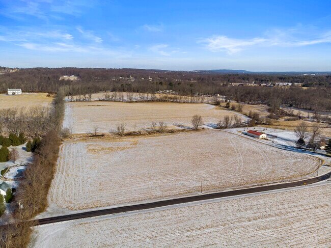
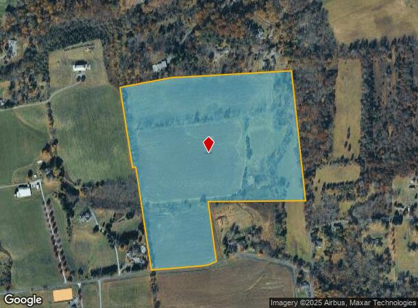
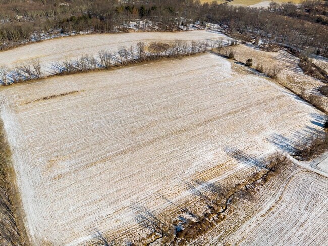
88 Yard Rd
Newark, NJ-PA
ADDITIONAL LOTS: DEVELOPMENT EASEMENT
07-00027-0000-00020-0000-Q0491
Hunterdon
Farms
New Jersey
AE
20
34019C0333F
44.06 AC
2024
Hunterdon
2025
Northern New Jersey
011600
DEMOGRAPHICS near 88 Yard Rd
1 Mile
3 Mile
5 Mile
2024 Total Population
483
5,958
25,966
2029 Population
482
5,990
26,254
Pop Growth 2024-2029
(0.21%)
+ 0.54%
+ 1.11%
Average Age
48
45
43
2024 Total Households
191
2,148
10,050
HH Growth 2024-2029
(0.52%)
+ 0.42%
+ 1.08%
Median Household Inc
$141,346
$147,089
$110,472
Avg Household Size
2.50
2.70
2.50
2024 Avg HH Vehicles
2.00
3.00
2.00
Median Home Value
$666,666
$638,037
$459,911
Median Year Built
1979
1980
1981
Nearby Places
Map Layers
Map Styles
 Street
 Aerial
- Restaurants
- Banks
- Shops
- Fitness
- Groceries
PUBLIC TRANSPORTATION
AIRPORT
Trenton Mercer
DRIVE
WALK
Distance
Trenton Mercer
38 min
18.8 mi
Freight Ports
Port of Philadelphia
DRIVE
WALK
Distance
Port of Philadelphia
73 min
40.1 mi
SALE & LEASE HISTORY
LISTING DATE
SALE/LEASE

Feb 05, 2020
For Sale
Nearby Properties
Address
Land Use
TOTAL SIZE
Lot Size
Zoning
Address
Land Use
TOTAL SIZE
Lot Size
Zoning
65.10 AC
I-1
Address
Land Use
TOTAL SIZE
Lot Size
Zoning
40 AC
AR-2
Address
Land Use
TOTAL SIZE
Lot Size
Zoning
5.47 AC
B-2
Address
Land Use
TOTAL SIZE
Lot Size
Zoning
2.64 AC
B-2
Address
Land Use
TOTAL SIZE
Lot Size
Zoning
10.40 AC
B-2
Address
Land Use
TOTAL SIZE
Lot Size
Zoning
11,756 SF
25.62 AC
A-1
Address
Land Use
TOTAL SIZE
Lot Size
Zoning
10.26 AC
B-2
Address
Land Use
TOTAL SIZE
Lot Size
Zoning
1,516 SF
5.09 AC
B-2
Address
Land Use
TOTAL SIZE
Lot Size
Zoning
4,122 SF
10 AC
R-1
Address
Land Use
TOTAL SIZE
Lot Size
Zoning
148.35 AC
AR-5
Address
Land Use
TOTAL SIZE
Lot Size
Zoning
7.98 AC
B-5
Address
Land Use
TOTAL SIZE
Lot Size
Zoning
72.39 AC
AR-2
Address
Land Use
TOTAL SIZE
Lot Size
Zoning
3.25 AC
B-5
Address
Land Use
TOTAL SIZE
Lot Size
Zoning
10,084 SF
2 AC
VAL
Address
Land Use
TOTAL SIZE
Lot Size
Zoning
10 AC
HO
Address
Land Use
TOTAL SIZE
Lot Size
Zoning
1,088 SF
3.59 AC
B-5
Address
Land Use
TOTAL SIZE
Lot Size
Zoning
11,594 SF
1 AC
VAL
Address
Land Use
TOTAL SIZE
Lot Size
Zoning
3.90 AC
B-2
Address
Land Use
TOTAL SIZE
Lot Size
Zoning
4.50 AC
B-5
Address
Land Use
TOTAL SIZE
Lot Size
Zoning
4,528 SF
2 AC
A-1
Address
Land Use
TOTAL SIZE
Lot Size
Zoning
7,171 SF
1 AC
A-2
Address
Land Use
TOTAL SIZE
Lot Size
Zoning
80 AC
R-1A
Address
Land Use
TOTAL SIZE
Lot Size
Zoning
1.69 AC
B-5
Address
Land Use
TOTAL SIZE
Lot Size
Zoning
7,272 SF
1 AC
A-1
Address
Land Use
TOTAL SIZE
Lot Size
Zoning
10,619 SF
1.75 AC
VIL
Address
Land Use
TOTAL SIZE
Lot Size
Zoning
6.79 AC
B-5
Address
Land Use
TOTAL SIZE
Lot Size
Zoning
9,394 SF
1 AC
A-1
Address
Land Use
TOTAL SIZE
Lot Size
Zoning
5,860 SF
1 AC
A-1
Address
Land Use
TOTAL SIZE
Lot Size
Zoning
1,224 SF
7.36 AC
B-5
Address
Land Use
TOTAL SIZE
Lot Size
Zoning
7,140 SF
2.50 AC
A-1
The World's #1 Commercial Real Estate Marketplace
Connect with us
© 2025 CoStar Group
The information above has been obtained from sources believed reliable. While we do not doubt its accuracy we have not verified it and make no guarantee, warranty or representation about it. It is your responsibility to independently confirm its accuracy and completeness. Any projections, opinions, assumptions, or estimates used are for example only and do not represent the current or future performance of the property. The value of this transaction to you depends on tax and other factors which should be evaluated by your tax, financial, and legal advisors. You and your advisors should conduct a careful, independent investigation of the property to determine to your satisfaction the suitability of the property for your needs.